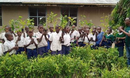
Linking Technology With Community Conservation in the Cubango/Okavango Basin
Introduction
Technological advances can contribute significantly to the conservation and management of nature, but these must be matched with the local knowledge of communities to be truly effective. It is in this context that the Association for the Conservation and Management of the Environment and Wildlife (ACGAVS) is starting to use unmanned aerial vehicles (commonly known as drones) to monitor community forests and national parks alongside local communities.
Drones allow us to monitor and map inaccessible and remote areas quickly, accurately and safely. Through the strategic use of drones, conservation managers and field monitors can collect a large amount of valuable information on which to base important decisions related to the conservation and sustainable management of natural resources. The kind of information we can collect includes deforestation activities, the presence and extent of forest fires, forest cover and health, plant growth, and animal identification and behaviour.
For research purposes, the detailed monitoring of flora and fauna with drones broadens our understanding of ecosystem dynamics in the Luengue Luiana and Mavinga National Parks in southwest Angola. For management purposes the involvement of communities is crucial, as the rangers’ raise awareness among communities and update them on the possible dangers of illegal activities and wildlife.
Training communities to use drones
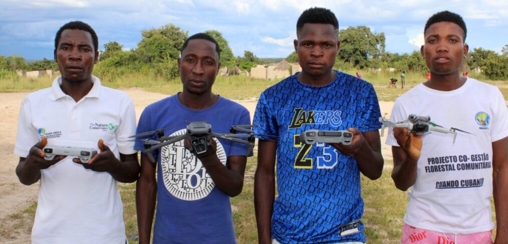
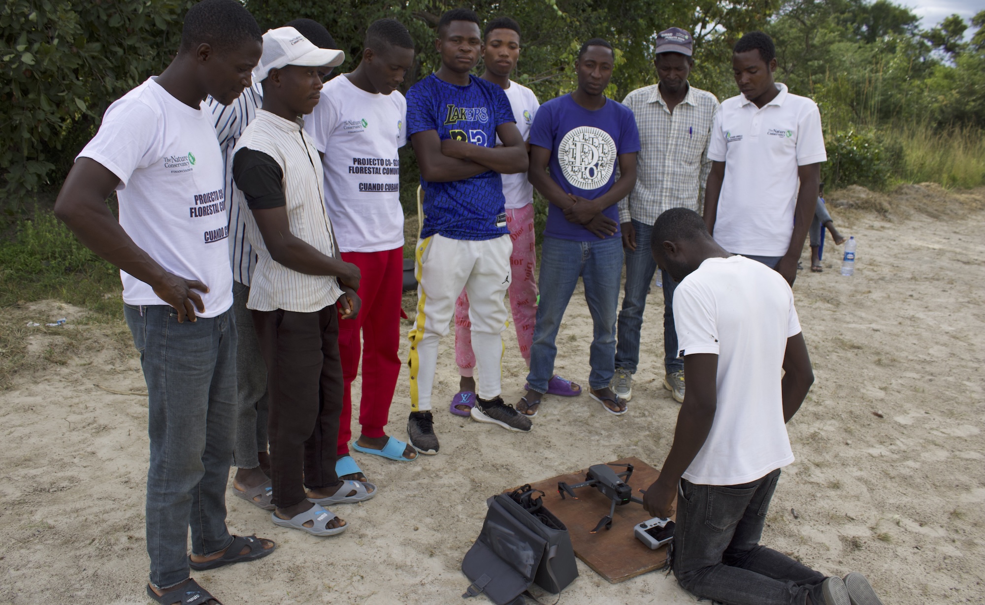
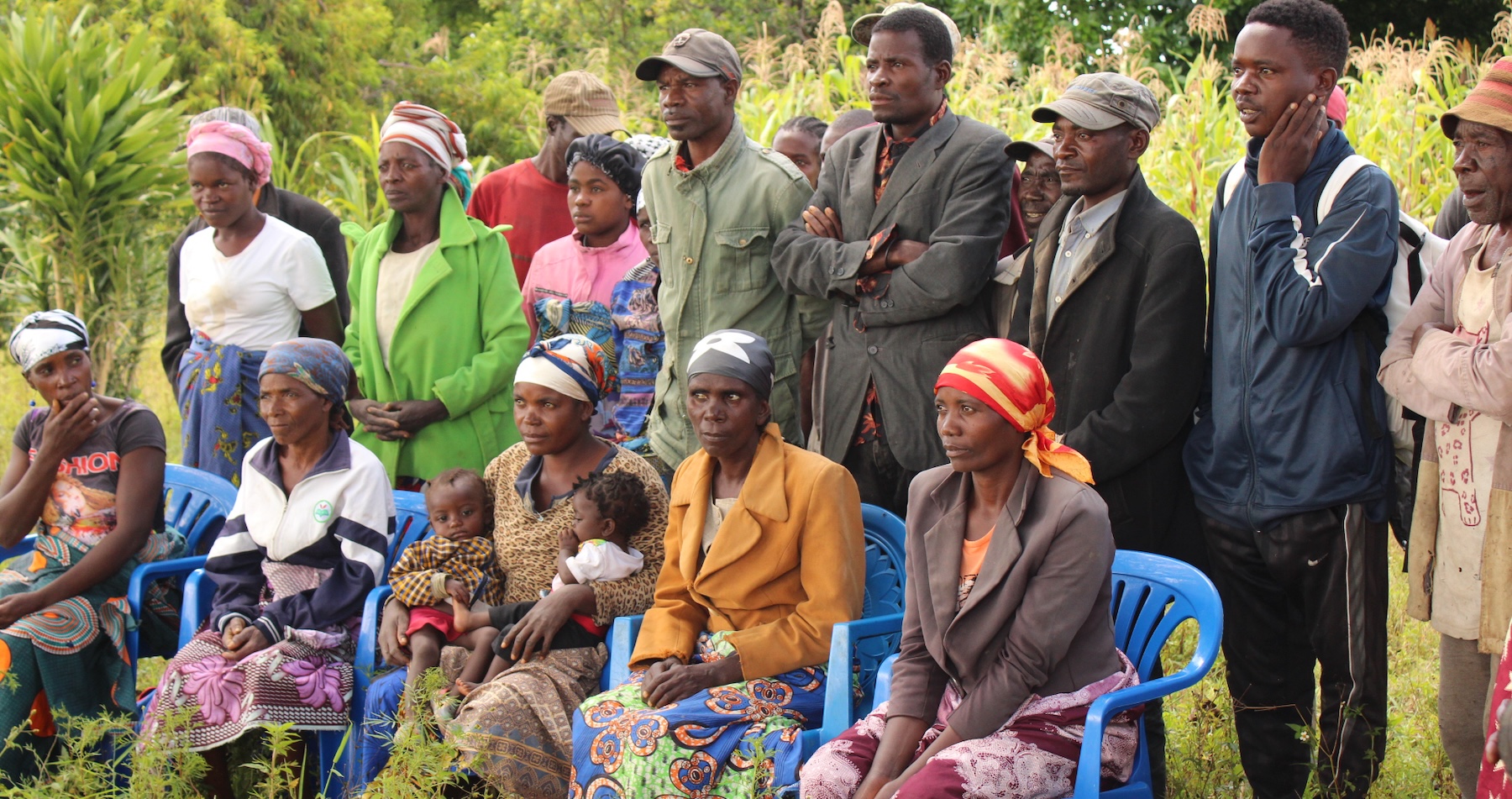
In our project in Angola, drones help us to monitor community forests in the upper Cubango/Okavango Basin. We recently trained community members and field monitors on the use of drones to monitor forest-damaging activities and evaluate the regeneration process of native species by monitoring forest cover and plant growth over time.
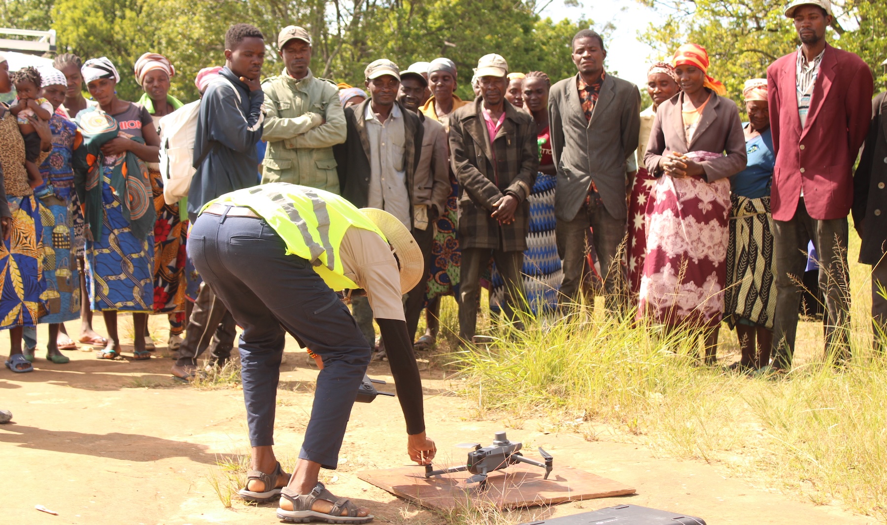
Drone content technician Raquel de Jesus explaining to the communities how to fly after theoretical lessons in the village of Sambu, Chicala-Choloanga municipality, Huambo province.
The training took place in 16 villages and towns (Menongue, Luassenha, Lievela, Lilunga, Liakonga, Livambi, Cuchi, Cutatu, Chinguanja, Chikonha, Utembo, Dumba, Sambu, Chinhama, Kambungo and Mucusso) in the Huambo, Cubango and Cuando provinces, with the involvement of IDF (Forestry Development Institute) officials, members of the Cuchi Administration and various partners working in the Cubango Basin. 47 trainees took part, 17 of whom were women. The trainees will undergo regular refresher training every six months.
The trainees learned how to assemble and disassemble the drone, calibrate the equipment for its stability during flight in the face of strong winds, and make sure that the drone’s camera is ready to capture images and videos from below 120 m altitude and nearly 5 km away from the operator.
The trainers from Halo Trust Angola’s Environment Department used the local language to make it easier for the trainees. The participants contributed their local knowledge on how to estimate the height of trees and where to send the drones to collect the required information. This combination of technology and local knowledge revealed the value of our community-centred approach.
Applications of drone training in the Cubango Basin
Monitors of the Luassenha, Lilunga, Liakonga, Lievela, Dumba and Mikongo forest cooperatives in the municipality of Cuchi in the Province of Cubango.
For the monitors, the use of this equipment will help them to gain knowledge about monitoring and mapping the area in detail, including areas that are difficult to access from the ground. These maps can be used to assess the health of the trees, identify areas with higher densities of planting or exploitation, leading to better forest management plans.
The drone images can also be used to measure the height and diameter of the trees, and thus estimate the biomass of the forest. Both planted and native forests can be monitored using these photos, which will be important to assess the progress of forestry projects in the Cuchi communities upstream of the Cubango Basin.
Manuel Cassanga, one of the trainees who lives near the charcoal tree harvesting area of the Ferro Guza factory, says that this equipment will make it much easier to monitor the growth of non-native trees and vegetation. The drones will cover the area covered by the factory and areas used by people from the surrounding villages to compare these impacts on forest health.
Another potential use of drones is to identify plant diseases and pests: the images captured by the drones can be analysed to detect signs of infestation, allowing the appropriate measures to be taken to prevent further spreading. Field monitors who operate the drones can report these issues to higher levels, leading to more effective decision-making. Cassanga said that one of the drone images he captured revealed the presence of mopane worms (known locally as “catato”) that could be used for food.
For trainee Madalena Mutango Ndala, the use of thermal drones was interesting because they can indicate the presence of a fire, enabling firefighting teams to respond more quickly and efficiently.
Thermal cameras allow animal species to be monitored during periods of low light, without the need for artificial lighting that can disturb the animals. They also make it easier to identify species, since animals emit different levels of thermal radiation depending on their size, metabolism and fur. Monitoring animal behaviour and the presence of illegal hunters at night is especially useful for both research and conservation purposes.
The amazement of the community as Victor Manuel makes his first flight, in the town of Sambu, 18 km from the source of the Cubango/Okavango basin (Boas águas) in Huambo.
Conclusion
The use of drones in collaboration with local communities will contribute significantly to the conservation and restoration of the Cubango Basin, especially the Conservation Areas and National Parks of the Cubango and Cuando Provinces. The Nature Conservancy aims to provide 17 drones to the project, with one for each of the target communities.
By providing accurate, real-time information, drones make a significant contribution to the planning and management of forests and areas allocated to communities, enabling better decision-making. And this is what the Cubango Basin needs, especially the communities living at the head of the basin. In addition, they will help to identify priority areas for conservation actions that will preserve ecosystems and promote sustainable practices.
This information is also valuable for developing public policies aimed at mitigating the effects of the drought that has affected the basin in recent years and promoting more efficient and sustainable management of existing resources.
The future of the planet depends on us, and the correct application of technology can make it easier to conserve nature for all those who depend on it. Local communities need not only responsibilities but also benefits, and training is one of them. Including communities in nature conservation and management activities is more productive than treating them as culprits that cause nature destruction. Using a combination of technology, local knowledge, and community cooperation, we hope to conserve the Cubango Basin for current and future generations.
Eduardo Ferreira
The series of training sessions ended with the presentation of a report to the Director of the Environment of Cubango Province and the award of the quality certificate to ACGAVS and the Community Consultants.